|
|
# 2020 Comfort Maps |
|
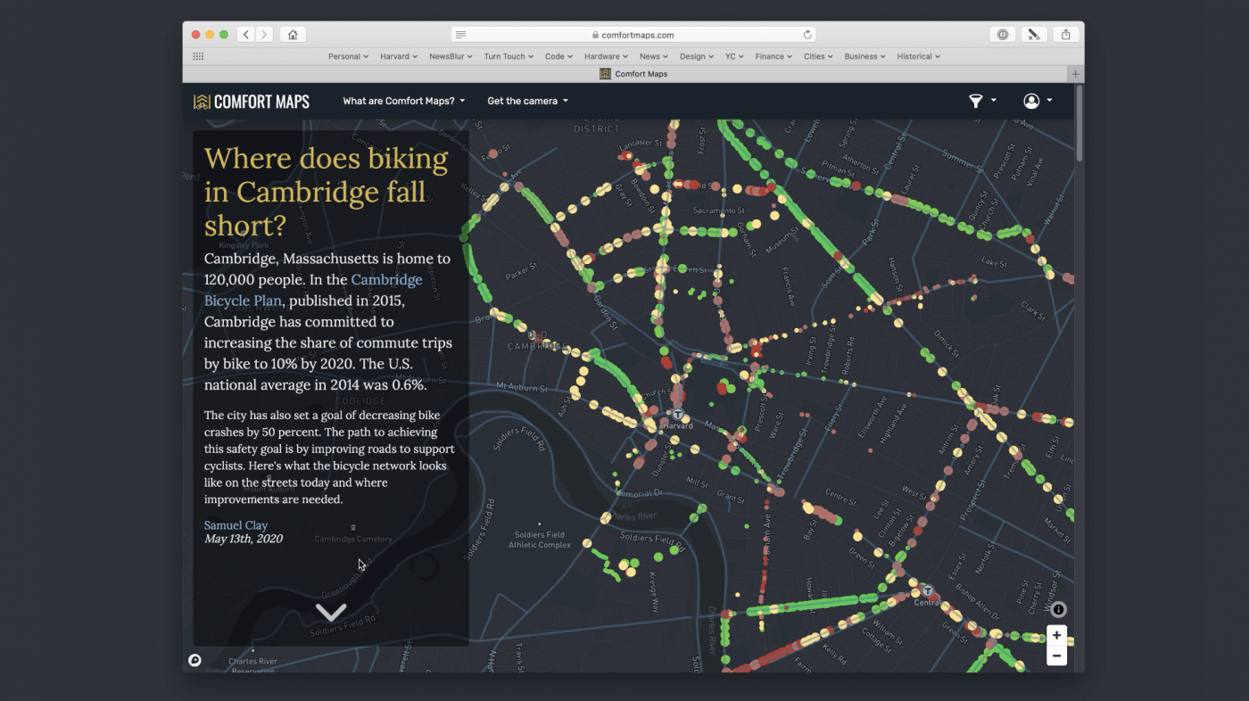
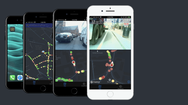
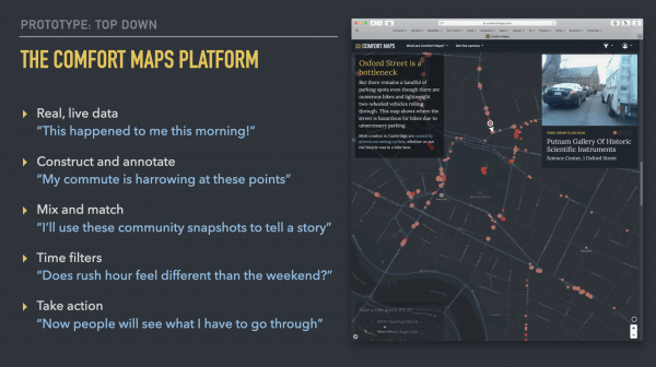
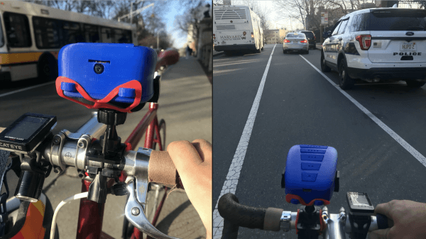
Millions of people are using e-scooters, e-bikes, and e-mopeds to commute but the streets we use are often unsafe as most bike lanes are inadequate to support the growth of greener modes of transport. Comfort Maps is a tool advocating the use of real-time street safety data in discussions with policymakers. Combining a physical hardware device that mounts on the handlebars of a bicycle or e-scooter with a data visualization platform, Comfort Maps creates a safe and easy method for rating the comfort levels of streets. Ratings and photographic snapshots provide information from direct experience that can improve safety for others.


Turning waste chicken feathers from the poultry industry into an alternative and lean source of edible protein.

American University of Sharjah
Using the byproducts of desalinisation to create new architectures

The Hong Kong Polytechnic University School of Design
A new bus seat to make public transport more accessible for those in need
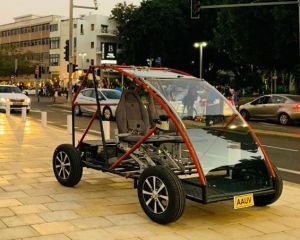
A safe, accessible vehicle to improve urban mobility for the elderly